May 12, 2026: Burnt Island Light

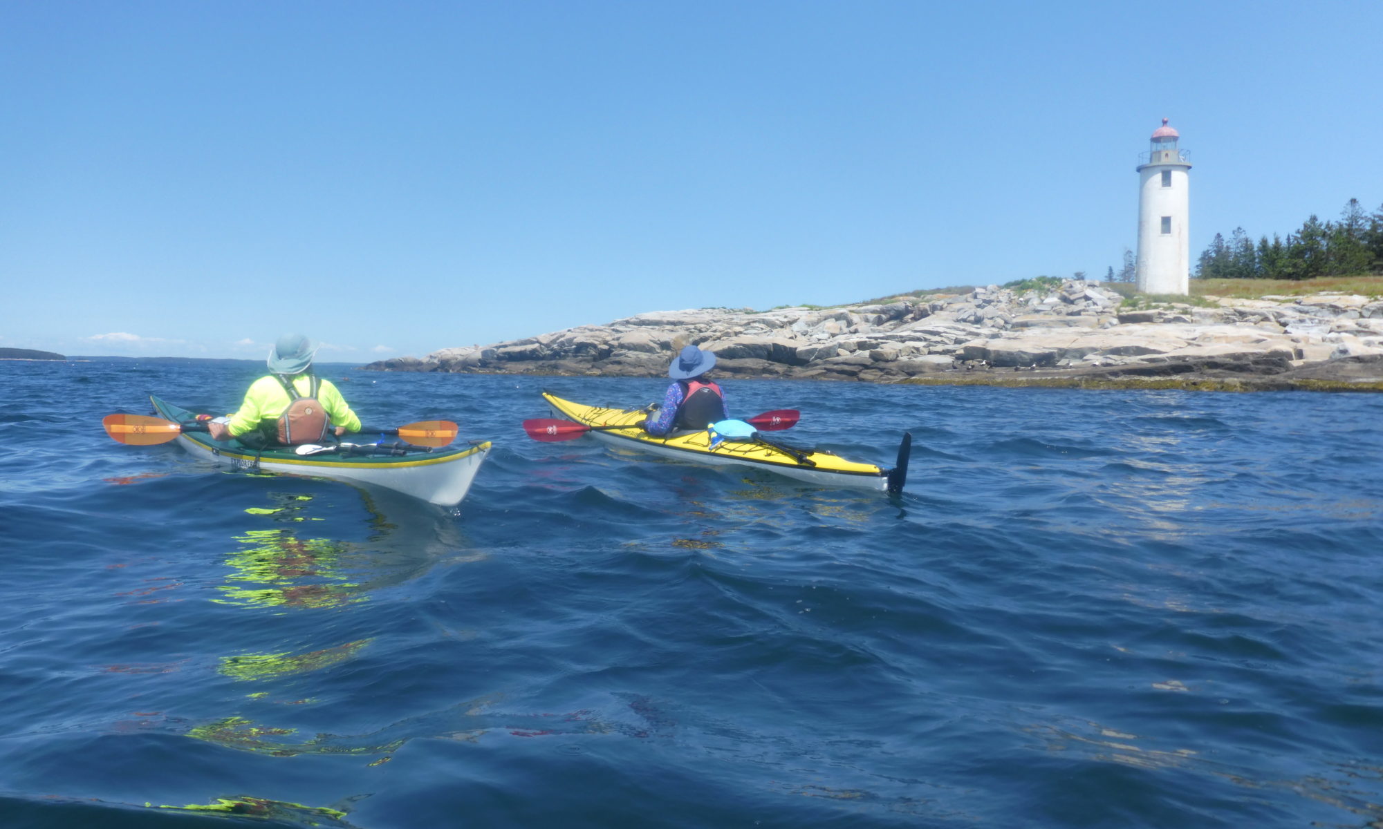
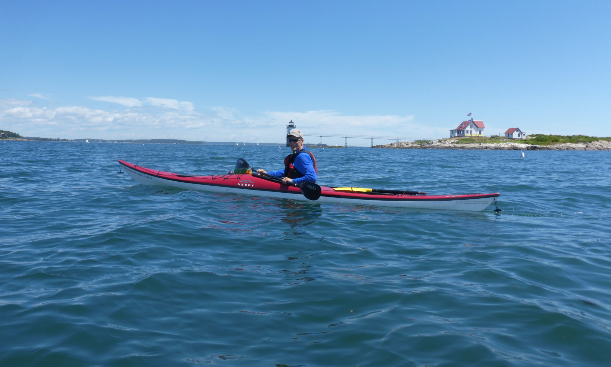
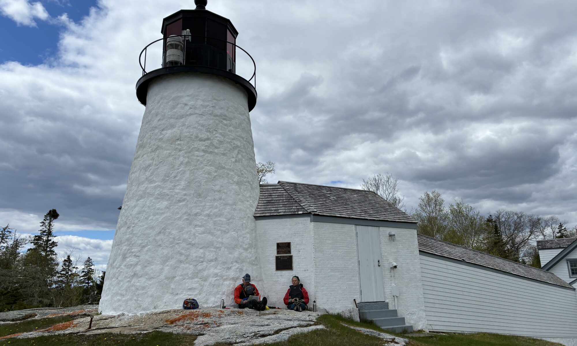
Burnt Island Light stands 30 feet tall on a five acre island marking the western entrance  of Boothbay Harbor. It was first lit in November of 1821, and is the second oldest surviving lighthouse in Maine. It is on the National Register of Historic Places, and can only be reached by water. On May 12, 2026 three PPCS members ventured out of the Knickercane Launch on Hodgdon Island in Boothbay with the goal of paddling to the lighthouse.  We’d monitored the wind for a few days and did expect a brisk NW wind with potential significant gusts, but we were planning to tuck into sheltered areas as much as possible. From our  launch into the Back River, we traveled in a clockwise direction around the southern tip of Hodgdon Island into the Sheepscot River. This took us into the delightful Isle of Springs area, which includes several islands that the public is allowed to land on, including a few available for camping. Some of these do have restrictions during osprey nesting months, so it is good to pay attention to that. We chose to land on Powderhorn, which has no bird related restrictions, and has a pretty beach, a few camping spots, and some comfy new picnic tables. After stopping to admire this island, we proceeded with a bit of a bouncy tailwind to the entrance of Townsend Gut. This affords a relatively protected passage between Boothbay and Southport, although wind can sometimes find its way through. As we exited the Gut, we stayed to the west of Mouse Island and entered the passage between Mouse and Burnt Island.  We paddled by an anchored barge with a crane and construction equipment. The Maine Department of Marine Resources is currently replacing the pier, gangway, and float system to support safer access for visitors.  Paddlers, however, traditionally land on the beach a little further east of the pier, and we easily landed there. We enjoyed lunch sitting against the lighthouse tower, a spot which provided a windbreak and pleasant views.  Burnt Island also has a small shed sized building with a couple flush toilets which were nicely in operation. On the return paddle we did feel the NW wind against us as we headed back through the gut. It provided some challenge as we exited the gut until we got into the lee of Indiantown Island. At the northeast tip of Indiantown we stopped and looked wistfully at the culvert that runs under  the bridge connecting Sawyer Island to Boothbay. At mid-tide, for a few hours, the culvert can be used to pass from the Back River along the east side of Sawyer Island to the east side of Indiantown Island, or vice versa, depending on which way the tide is flowing.  This cuts a few miles off the trip, and that day would have saved some distance against the wind, if we were returning a little later in the day. We arrived at dead low tide however. We had known the tide would be too low to pass through, but I had wanted to point it out along our “tour” of the islands. Still, we could not help thinking that it would have been nice on that particular windy day.  We tucked out of the wind as much as we could for the next mile or so as we continued westward, until we could leave the Sheepscot and re-enter the more sheltered water of the Back River. Once we reached the Back River, we continued clockwise around Hodgdon Island, completing a circumnavigation of that island between our launching and landing. Our total trip journey was a little over 10 miles, although we didn’t measure it officially. We got bonus points for effort against the wind. It would be fun to do it again on a calmer day and get a few more members along. We decided it would be ideal to plan it with tides that would allow a shortcut through the culvert on the return.

Trip Participants: Ron Chase, Bruce Weik, and TC Cath Kimball
Sep 6, 2024: Sea Kayak to Wood Island Lighthouse

TC: Shweta Galway

Trip Participants: Shweta Galway, Ryan Galway, Jean Miller, Bill Stafford

The original day was supposed to be Saturday the 7th. However mother nature waved her mighty hand, and with higher than expected seas on saturday, we quickly made plans to try for the day before. The predicted weather for friday was fog to start that was supposed to clear up as the day progressed.

We put in at Marblehead boat launch in Biddeford on the Saco River. The planned excursion was estimated to be about 4 miles out and 4 miles back, with a half mile walk to the lighthouse from where we landed.

We started on the Saco river and kayaked out to the end towards Saco Bay, dodging some boat traffic. The  4-6 feet long jumping sturgeon kept us entertained as we made our way out and kept our minds off the fog. We could not get behind some protected islands as quickly as we hoped due to the long breakwater, but the seas cooperated and we were able to navigate forth. We had a GPS device that helped point the way which was definitely needed as visibility was lower than hoped. We stopped at a midway point, Stage island, to regroup and gauge feelings about going ahead. Everyone agreed that we had come this far and we could make it out to Wood island which was visible in the distance, about another mile. So back into the boats we went. We avoided the daunting surf waves that were crashing along the right side of the landing dock as we approached and got in just fine.

Wood Island lighthouse is situated on the other side of the landing dock and is not visible when you land. However the beautiful boardwalk just beckons you. The walk was about a half mile on a well-maintained boardwalk and as you approach, the lighthouse and the keepers quarters are so quaint and inviting. We could not go into the lighthouse itself, but there are tours that are available from Friends of Wood Island Lighthouse.

The predicted clearing of fog was incorrect and in fact, on our approach back to the boats, it seemed the visibility had gotten worse. Thankfully someone in our group was smart enough to bring a light! We masterfully skirted the surfing waves as we took off, and quickly realized the waves were picking up. Fortunately we made our way back with a little more shelter from the island and with help from the tide, the mouth of the river did not seem as far out. Jean even caught some surf- unintentionally – or so she said!

All in all, we were very happy that we completed the trek. The TC learned to be better prepared, and that mother nature does not care what the weather person predicts, she will do what she wants!

Jul 9, 2023: Narraguagus Bay and Harrington Bay, near Milbridge, Maine, Washington County

An anticipated gap in the rain, and flat calm conditions, provided an opportunity for paddling in the waters between Petit Manan Point, in Steuben, and Cape Split, in Addison.  From that broader area, we chose this time to do the central portion of the area from Milbridge boat ramp, across Narraguagus Bay and Harrington Bay, through the nearby islands to the Harrington boat ramp.  That more restricted area offered opportunity for shoreside paddling, with sheltered coves, in case the existing fog came in thicker during the trip.

The morning of the paddle, with the 12-foot tide at dead low, we opted to reverse the course, putting in at the deep-water launch in Harrington, heading generally westward, and then riding the incoming tide up to an easier and less muddy takeout in Milbridge.

With visibility about 300 yards at our 1100 hours launch, we paddled south along the western shore of the Ripley Neck peninsula until we were abreast of Dry Ledge and its large seal colony about a half mile offshore to the west.  Venturing off from the shore of Ripley, we could maintain visual contact with the Ripley shore until we could easily see Dry Ledge, and then, moving westerly, the two other ledges leading us across a mile and a half of water to the eastern shore of Foster Island.  Plenty of curious seals took time from their corralling of schools of menhaden (or pogies) to visit us.

Since some paddlers were new to the area, we then explored two coves on the eastern shore of Foster Island that are both scenic and provide good refuge if the weather turns bad.  (the TC is very big on having plenty of refuges available.)

With the visibility increasing and the sun getting brighter, we paddled southward along Foster, across the channel to Dyer Island, and into the lovely and super protected Northeast Cove for a break.  It’s a beautiful inlet, albeit shallow at low tide, with Strout Island, Otter Island, and tiny Isabel Island (the latter claimed and named by the TC’s granddaughter on a previous visit) visible from the inner cove.

From Northeast Cove, with the tide running inward from astern, we coasted back north along the northeast shore of Dyer Island, and then quartered northwest in the current between Dyer and Foster, across the two-mile, open-water run of Narraguagus Bay to Fickett Point and the mouth of the Narraguagus River.  From there, the incoming tide carried us up through the lobsterboat anchorages to the Milbridge takeout at the boat ramp.

Total time afloat was about three hours and 40 minutes, with total distance 7.5 nautical miles, or 8.6 statute miles.

Paddlers were Andra Lotze, director of development for the Steuben-based Eagle Hill Field Research Institute; Rick Vanderpol, a visiting instructor at the institute; PPCS President Helen Hess; and TC Norm Olsen.

Notes on the area:

The shuttle between Milbridge boat ramp and Harrington boat ramp is about 20-25 minutes and 14 miles, up Route 1A and then south on the Marshville Road (a half mile east of the Irving station) leading down the Ripley Neck.

The Harrington launch area has parking but no other facilities.  The Milbridge launch area has a small park, picnic tables, porta potties, and plenty of parking.  Two miles south of the Milbridge launch, on the western shore, is Chipman’s lobster pound and seafood takeout, which has a ramp where paddlers can haul out, and a lovely rooftop deck on which to dine.

While this entire area is largely protected from swells, that two-mile stretch across Narraguagus Bay can get uncomfortable in a breeze, particularly if the breeze and tidal current are running in opposite directions.  If wind, sea, current or fog had been less favorable, we would have gone north and west from the Harrington put-in, across the few hundred yards to Ray’s Point, and then right along the shore inside of Foster Island and around Fickett Point to the Narraguagus.  Along that route, Flat Bay and Back Bay offer lovely, protected paddling, with lots of wildlife.

Farther offshore are another dozen principal islands and even more ledges, but few decent landing spots.  Flint Island, directly south of Dyer Island and owned by the Nature Conservancy, has a stony beach on its northern side.

Tiny Mink Island, on the east side of the Ripley Neck in the mouth of the Pleasant River, is a Maine Island Trail campsite, but landing is over the ledges.

Sheep Island, farther south, close along the Addison Shore and just a few hundred yards off the west side of Cape Split, is also a MITA site and has a lovely, protected, sand beach and easy camping.  Sheep Island is easily accessible from Cape Split causeway which has a couple of pull over parking spots.  MITA also has a site on the northeast side of Bois Bubert Island that is accessible from the launch ramp on the road leading to Petit Manan Point.

Jun 21-22, 2023: Eastern Egg Rock

Typically, the almost annual Eastern Egg Rock trip to visit the puffins began with confusion about the weather.  Initially, we had a near perfect forecast.  The night before, a prediction for fog raised its ugly head.  When six of us met at the Friendship Boat Landing, the weather was superb.  Our plan was to camp overnight, so we paddled four miles to the campsite on Black Island first.  Two members in the group, decided to remain in the area.  Although there were fog banks to our east and west, four of us had glorious conditions for our cruise to the rock.  Thanks to club member, Liv Ridley, who works on the rock, we knew the puffins were there.  As always, they were a treat.  Our return to Black was equally enjoyable.  Three of us spent the night while ex-president DeCoster logged in a 17 mile day and returned home.  Camping conditions were excellent but we awoke to dense fog.  During breakfast, we experienced a unique fog bow.  We outwaited the fog and paddled to Harbor Island for a trek across the island to cliffs on the west side.  From there, we returned to Friendship completing an exceptional two-day adventure visiting the puffins, experiencing a fog bow, and hiking the cliffs of Harbor Island.  

Participants:  Ellen Nelson, Mark Nelson, Jean Miller, Ken Gordon, Ex-president DeCoster, and TC Ron Chase

Jul 27, 2022: Damariscove Island

Damariscove Island is one of the finest sea kayak trips on the Maine coast.  Mark Nelson joined me for a club trip on a hot summer day.  We paddled out against the tide with a gentle tailwind in calm conditions.  As is often the case, that changed when we reached ledges called The Motions at the southern end of Damariscove.  Large swells and breaking waves were encountered and continued part way into the cove.  We hiked to cliffs on the east side for lunch.  The swells entering the cove had diminished when we exited but navigating between a series of confusing surging waves was necessary.  The winds reversed and we enjoyed a tailwind for the remainder of our voyage.

Participants:  Mark Nelson and TC Ron Chase