

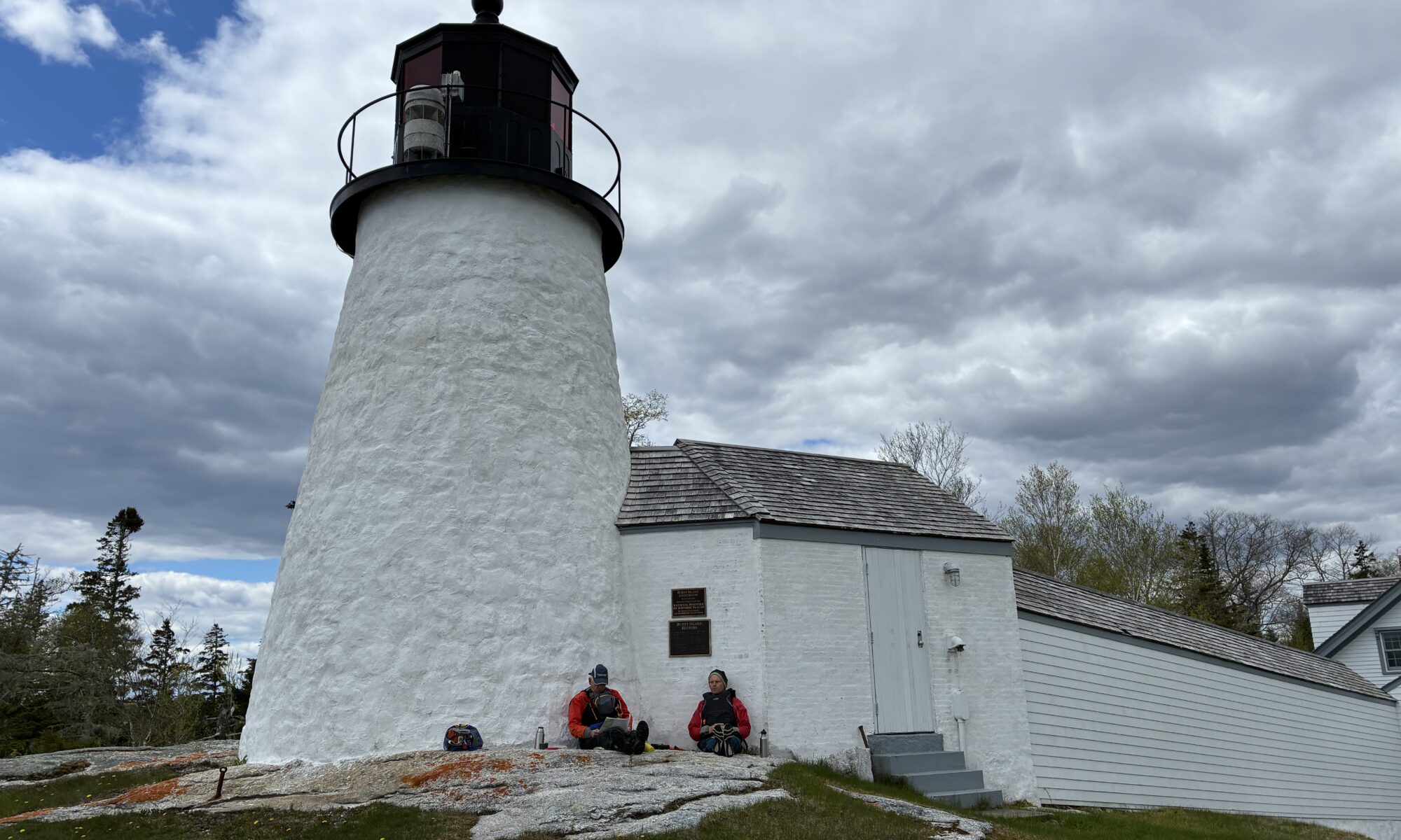
Burnt Island Light stands 30 feet tall on a five acre island marking the western entrance of Boothbay Harbor. It was first lit in November of 1821, and is the second oldest surviving lighthouse in Maine. It is on the National Register of Historic Places, and can only be reached by water. On May 12, 2026 three PPCS members ventured out of the Knickercane Launch on Hodgdon Island in Boothbay with the goal of paddling to the lighthouse. We’d monitored the wind for a few days and did expect a brisk NW wind with potential significant gusts, but we were planning to tuck into sheltered areas as much as possible. From our launch into the Back River, we traveled in a clockwise direction around the southern tip of Hodgdon Island into the Sheepscot River. This took us into the delightful Isle of Springs area, which includes several islands that the public is allowed to land on, including a few available for camping. Some of these do have restrictions during osprey nesting months, so it is good to pay attention to that. We chose to land on Powderhorn, which has no bird related restrictions, and has a pretty beach, a few camping spots, and some comfy new picnic tables. After stopping to admire this island, we proceeded with a bit of a bouncy tailwind to the entrance of Townsend Gut. This affords a relatively protected passage between Boothbay and Southport, although wind can sometimes find its way through. As we exited the Gut, we stayed to the west of Mouse Island and entered the passage between Mouse and Burnt Island. We paddled by an anchored barge with a crane and construction equipment. The Maine Department of Marine Resources is currently replacing the pier, gangway, and float system to support safer access for visitors. Paddlers, however, traditionally land on the beach a little further east of the pier, and we easily landed there. We enjoyed lunch sitting against the lighthouse tower, a spot which provided a windbreak and pleasant views. Burnt Island also has a small shed sized building with a couple flush toilets which were nicely in operation. On the return paddle we did feel the NW wind against us as we headed back through the gut. It provided some challenge as we exited the gut until we got into the lee of Indiantown Island. At the northeast tip of Indiantown we stopped and looked wistfully at the culvert that runs under the bridge connecting Sawyer Island to Boothbay. At mid-tide, for a few hours, the culvert can be used to pass from the Back River along the east side of Sawyer Island to the east side of Indiantown Island, or vice versa, depending on which way the tide is flowing. This cuts a few miles off the trip, and that day would have saved some distance against the wind, if we were returning a little later in the day. We arrived at dead low tide however. We had known the tide would be too low to pass through, but I had wanted to point it out along our “tour” of the islands. Still, we could not help thinking that it would have been nice on that particular windy day. We tucked out of the wind as much as we could for the next mile or so as we continued westward, until we could leave the Sheepscot and re-enter the more sheltered water of the Back River. Once we reached the Back River, we continued clockwise around Hodgdon Island, completing a circumnavigation of that island between our launching and landing. Our total trip journey was a little over 10 miles, although we didn’t measure it officially. We got bonus points for effort against the wind. It would be fun to do it again on a calmer day and get a few more members along. We decided it would be ideal to plan it with tides that would allow a shortcut through the culvert on the return.
Trip Participants: Ron Chase, Bruce Weik, and TC Cath Kimball